

Port Hastings
When I was here in July there was a rather jolting drop from the bridge to the road, I am pleased with the smoothness of the new pavement. I am now on Cape Breton Island. Port Hastings area to be exact. First stop is right here. I swing into the drive way on the left. I have to take photos of the National Historic Site plaque, look at the Ceilidh Coastal Trail map and the starting point marker 0 , (also part of the greater Trans Canada Trail). Then, read what it has to say on the tourist information boards. All interesting stuff to me.


Next stop ( pretty much across the road) The Tourist Information Center. It is closed for the season but the display at the back of the building draws me in. There is a plaque and a statistic board for those that like the where, when, what’s and how’s of the building of the causeway. There is a book note for a Cape Breton must read; No Great Mischief by Alistair MacLeod, a mural, and a monument erected by the Nova Scotia Association of Scottish Societies, with the names of some famous Scottish-Nova Scotian..


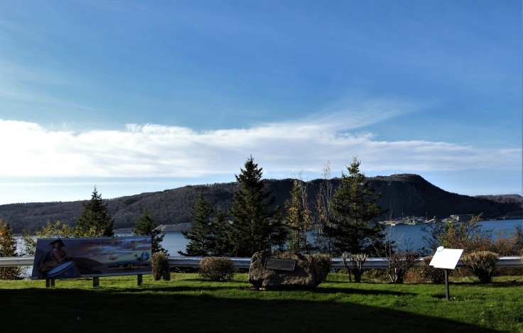
The view to Porcupine mountain is lovely. The tourist bureau is located at 96 NS-4, Port Hastings.
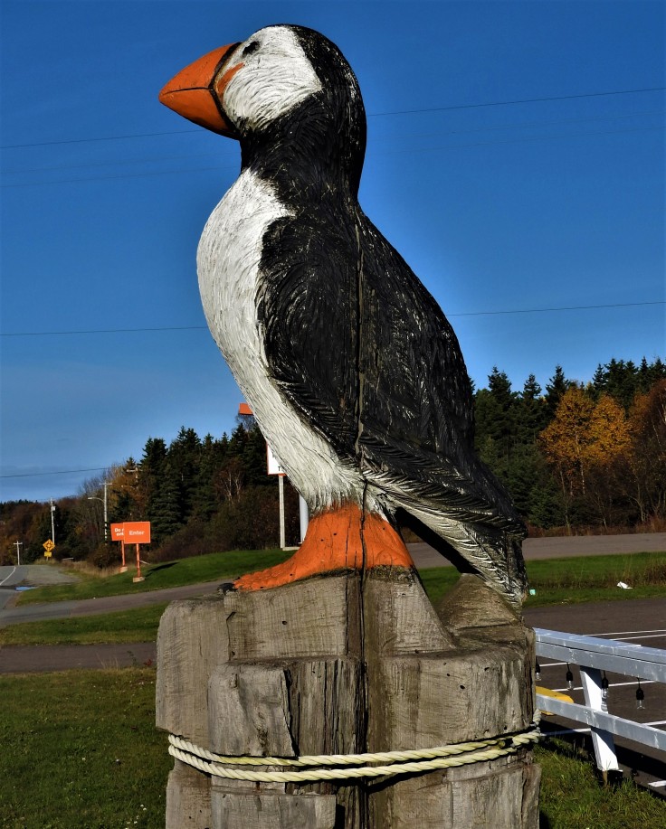
Next up A road side attraction. A large carving of an Atlantic Puffin, there is a step you can get up on and take your picture with him. (of course I did:)
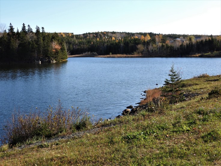
I continue on highway 4 towards Embrees Island and take a stroll around the Pioneer Cemetery. The headstones are mostly just rocks with no inscriptions, but the link above has the names and dates of those laid to rest here. It has a pretty view across to the main land of Nova Scotia, and Porcupine Mountain.

Port Hastings also has a historical society and a museum. Both closed on my visit.
Port Hawkesbury
If the Ceilidh Coastal Trail seems too ambitious for you, try the Port Hawkesbury Trails Ten kilometers of trails through a natural setting starting in Grants Pond. Plenty of parking, look for the sign on the left side of he road on Highway 4 before the hill.

There is also a board walk down at the water front, (sorry no picture) you can turn onto Granville Street, from here then take MacSween down to water street. A walk with a water front view. In the summer there are outdoor concerts, here called Granville on the Green.
After a brisk hike. I go up the hill to the veterans Memorial Park. At the corner of McSween and Reeves street. It is that time of year to pause for a moment and pay our respects to the past and present serving military members, and to those that lost their lives in the service of our country. The park is beautifully done, created around the center cenotaph. Names of local heroes inscribed on a wall, several sculptures for the art lover and a large anchor in tribute to the Navy. It was prepared for the November 11th ceremony when I took this.


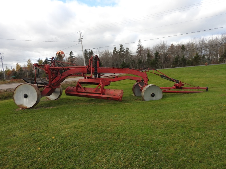
I have one more stop In Port Hawkesbury; another Road Side Attraction. Located on Highway 4 just outside the plow storage garage called the Transportation and infrastructure building. An old grader parked on a very green lawn for a November day.
We leave Port Hawkesbury behind and Continue on highway 4 for about thirteen kilometers.
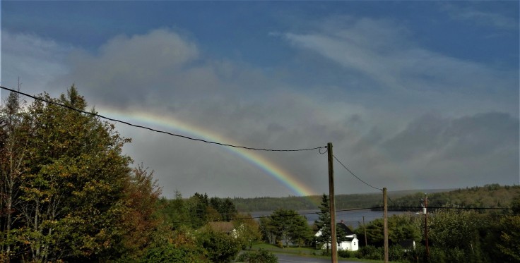
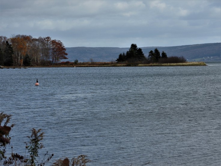
Cleveland’s show piece is, River Inhabitant. A tidal river that has tidal pools from the opposing force of a flowing river against and incoming tide. There is a boat launch at the end of the river, down by the highway and after a sun-shower, a rainbow is often visible
In season, fishing off the bank on the Riverside Road is possible. It is very pretty in all seasons.

Cleveland Falls We turn up County Line Road, the sign says West Bay, Dundee Marble Mountain St Georges channel. A couple of hundred meters up the road around the turn is a brook. (There is very little shoulder to park on here so be careful) There is supposedly a trail on the hill but I walked up the brook. It was challenging with lots of downed trees and unstable rocky ground requiring a bit of crisscrossing the brook. I would say it was about twenty minutes of bushwhacking to arrive at the water falls. Some people call it Ferguson Falls, after the previous land owners but it is and un-named falls. It was dry with very little water flowing but the forty-foot height of the rocks and the almost brick like wall beside it impressed me. I can’t believe I didn’t know this was here. I loved it and I will return some day after a good soaking rain.

After exiting the forest, it is back on county line road for one last stop.
West Bay Village song by Tim LaBorie
This is where my family heritage is. A pretty village at the head of the bay peppered with historic homes and rich cultural roots. Many of the families that live here, have been so for generations. A hundred years ago, it was a center of commerce. Large boats docked and unload and loaded wares at the wharf. There was a tanner, a mill and a store. Today West Bay is part of the Bras d’Or Lake scenic drive, and Bras d’Or Lakes UNESCO Biosphere Reserves.. Kayaking, boating, are popular in summer and winter skating, and snow shoeing. are frequent activities. You can see Eagles Cormorants, various ducks-great for bird watchers, plus the odd seal and beaver are here to. A new fish ladder has been added at the river at the cross roads, and one Road Side Attraction; an Anchor in a rock. Several very large old Pine trees are visible in the village.


Please join me for Part three as we continue to look around familiar places. Next is
Dundee
River Bourgeois
St Peters
Cheers from Maritime Mac

Contribute
If you like this content you can tip me to show your appreciation. and ensure the continuation of this blog
C$2.00


Granville Green is always a good time in the summer – I definitely miss it now that I live in Ontario 🙂
LikeLike
agreed, thanks for reading it. So you are a Caper?
LikeLiked by 1 person
I am indeed. Originally from Margaree!
LikeLike
Oh my Moms family are from Margaree, they use Names were Elmourne. Use to own the old house beside where the Co-op use to be, It was moved in the late 80’s after my Grand mother passed away and the canteen is was moved across the road it is called Miles from No where.
LikeLiked by 1 person
That’s so cool! I grew up in the Forks, but my family is originally from the Harbour – last name is Laurence 🙂
LikeLike
I also the Dunn, Codys few others I can’t think of , we will have to keep in touch. I Lived in TO for 20 years, I was a jockey at Woodbine for 20 years. I moved back east in 2009
LikeLiked by 1 person
It was so great to come across your photo of the Bookmark for No Great Mischief! I’ve been volunteering for Project Bookmark for a few years and I think NGM was an excellent choice for the first Bookmark plaque in Nova Scotia. (The second one, for Hugh MacLennan’s novel Barometer Rising, will be unveiled at the Halifax Citadel on Dec. 5th.) Thanks for sharing all the photos and the story of your trip to Cape Breton.
LikeLike
I was very happy to do it and I will read Barometer Risings, I loved No Great Mischief. The little details are the stuff I love to uncover. Cheers
LikeLiked by 1 person
Thanks so much for visiting my blog I am honoured
LikeLiked by 1 person
Although I live in Halifax and I’ve been to Cape Breton many times over the years, I haven’t visited since the No Great Mischief Bookmark was unveiled, so it was especially lovely to see your photos. I’m hoping there will be many more Bookmarks in the Maritimes in the future. It’s such a great idea to mark the real places where fictional scenes are set. I’m excited about the unveiling that’s coming up next June, in PEI, for L.M. Montgomery’s poem “The Gable Window.”
LikeLike
I was on the Project book mark website. What a great Idea. I love it. I posted it to my FB page. I will be sure to keep updated on unveiling.
I must admit, I had not heard of the project, till I saw the one at the Port Hastening tourist center. I will make them a part of my stories, A great tourist trail to follow.
LikeLiked by 1 person
Did you see the newsletter, “The Letter B?” If you’re interested in updates, you can subscribe to that (http://www.projectbookmarkcanada.ca/newsletter/). There’s more information about the Barometer Rising Bookmark in the Spring 2017 newsletter. I’m hoping to visit more of the Bookmarks across the country. So far, the only one I’ve seen is the one for The Republic of Love, by Carol Shields, which is in Winnipeg. I really must get to Cape Breton!
LikeLike
Thank you for the link Sarah, I will subscribe to the news letter. I am interested in seeing more of them as well. You must get up to CB, only 3 hrs away but weather might be a factor this time of year.
LikeLiked by 1 person
Looks like a beautiful place to visit!
LikeLike
ranked @1 island in the world by several travel magazines. I am fortune to call it home
LikeLike
Ah, Cape Breton!
LikeLiked by 1 person
It is my childhood home. I more posts coming up next month about CB. Thanks for reading
LikeLike