
Map of Points of Interest Midland area of New Brunswick.
Update: February 28th, 2021. Please park along road side, not in the farmers field. This is private property and the owner has been gracious enough to allow people access.. BE RESPECTFUL, NOT DO LITTER, OR LEAVE THE TRAIL Keep children under your control and use at your own risk.. With the pandemic this has become a very popular location.
The January thaw has melted the snow back but the temperature has dropped overnight to -6 Celsius, and the air is calm. One of those perfect winter days I mentioned in my story, Off Season- Tourism and I plan to make the most of it.
I grab my backpack and fill it with snacks and water, check that my camera batteries are fully charged and my SD card is inserted. I throw some spare clothing and my travel play book in the truck and I am out the door in 10 minutes. The drive will take me through familiar territory: Cambridge Narrows. I visited here for my post It All Started With Love. and I will drive past the road to The Cuts Quarry; A Swimming Hole Secret.
Two weeks earlier I had gone in search of the trail head. There had been a stretch of freezing temperatures and with the snow cover, I thought it would make for a pretty hike. But I wasn’t 100% sure where the trail head was and I decided not to proceed. It was already 3 pm and if anything went wrong I would be returning in the dark. However, that reconnaissance trip will be useful today – I know where I am going.
I pull over briefly on highway 695, where a cranberry field has caught my eye. It is clear of snow and the reddish, undulating field should make a nice photo.

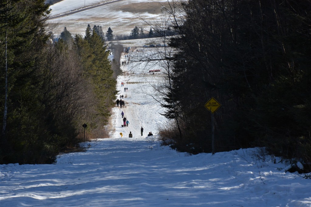
My GPS directs me to Midland, but I have drawn a map and written down instructions from the Hiking New Brunswick website to get me to the trail head. I see a BMW parked in the field and I pull up along side it. I secure my truck, shoulder my backpack, loop my camera around my neck and start hiking toward the tree line.

I pass a juncture where a tractor has made a path to the left at the edge of the field. I check what I have written as trail instructions, “…the trail climbs a steep section into the woods.” I keep hiking into the forest for about 700 meters, then I stop for a photo.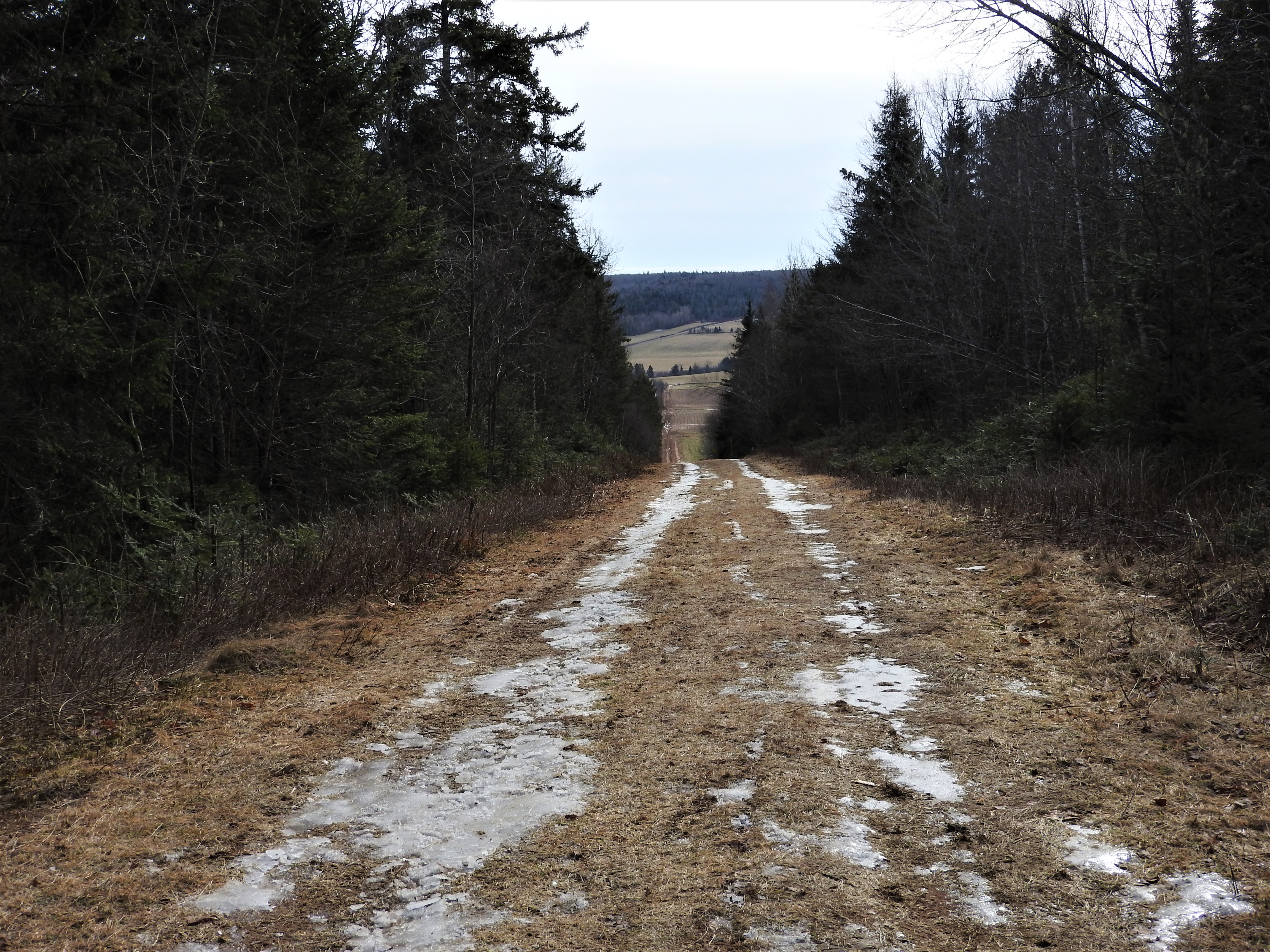
The trail is not well marked and I second-guess myself several times. At the top there is a bit of a wide space and footprints moving off to the left. The main road keeps going. My notes say take a left at the junction about 347 meters past the top. Have I gone that far from the top? I decide to follow it, and within half a kilometer I see a sign for the caves to my right and I hear two voices coming towards me.
I meet up with a couple on the path, and ask, “Did you make it to the ice caves?” They said they had. She said it she didn’t make it down the path – it was all icy and even though someone had put a rope up, it was too slippery. I take notice of her boots – they are calf-high leather dress boots, better for walking around the city than the woods. I reply, “Well I am alone so I am not going to take any chances, if it’s too dangerous I wouldn’t go.” They assure me I can get pictures from the top.
I keep going, they walk away.

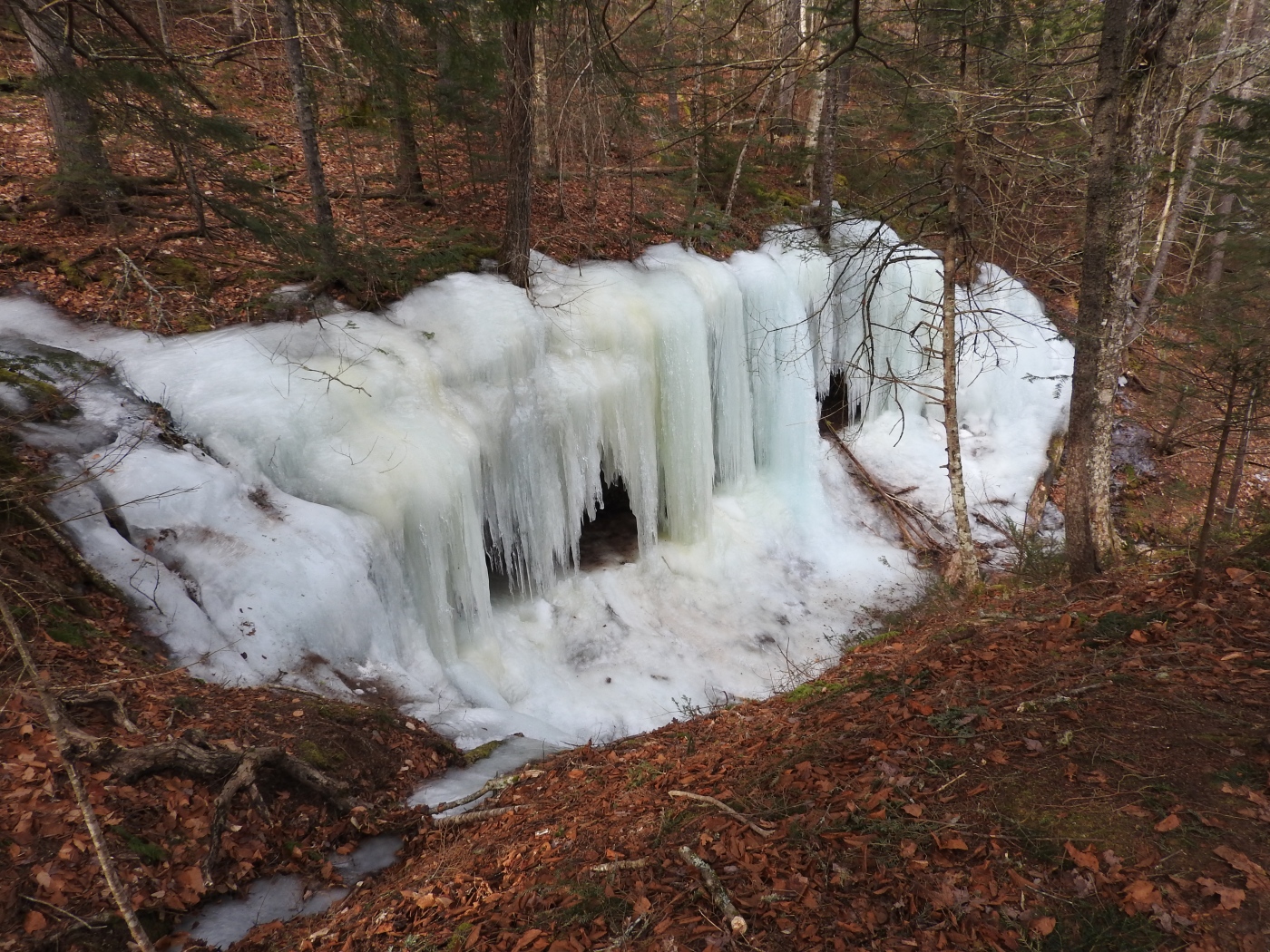
Three minutes later the trail sort of ends and I am not sure where to go. There are no markers or trail signs and I look for foot prints or trodden areas. I go off to the left but it ends in a tangled mass of alder trees and I retreat, not wanting to become lost. Standing back at the same place, I see a coffee cup and I walk towards it. Right in front of me is a cliff rimmed with ice and I know I have found it – in fact, I am on top of it. I need to get to the other side. I pick my way down the bank to the narrowest area and jump the stream, then follow the rope path. I am stopped in my tracks at the fantastic view.

I stay low, using my hands to guide me to the stump of a tree at the bottom. A pole has been placed to help you shimmy yourself up into the opening of the cave. A large hunk of ice at the top makes a good hand grip and I heave myself up and inside, slightly shaking at the exhilaration and fear. If I get hurt it might be tricky getting out of here.
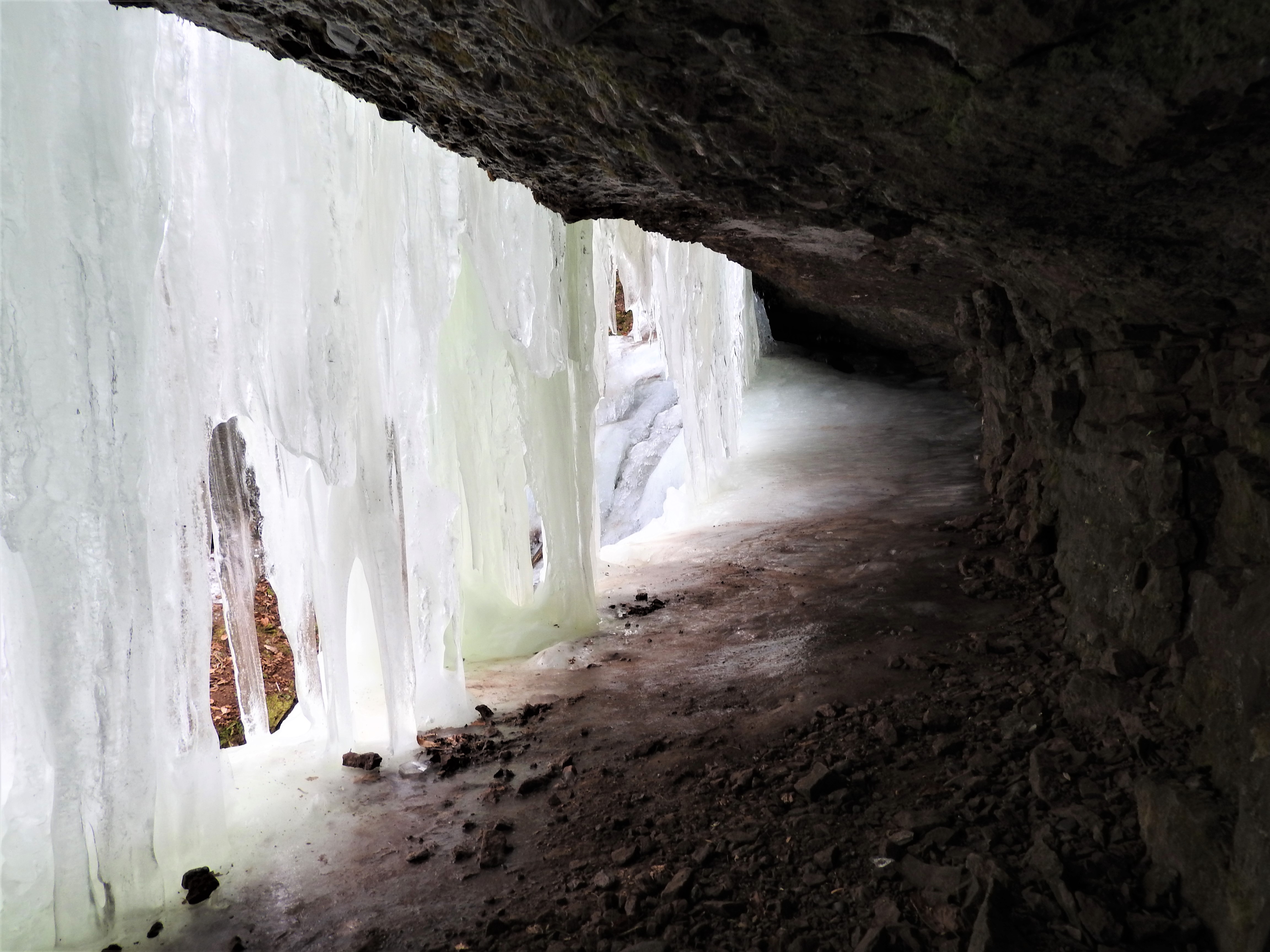
Inside the the cave is quite magical. It is illuminated by the ice sheet. Water droplets form on the end of an icicle, they swell and fall to the floor of the cave. It is a shelter and a coffin with not much room. I set my camera up for a timed shot and then plan my approach back down the the pole.

Just as I exit and make my way back across the stream, I hear voices approaching from the other direction. Two couples with walking poles stride up. I ask,” How did you get in from that direction?” They tell me it is a short hike out to the main road. I must have taken the long route.
They invite me to follow them out, if I can stay for a few moments while they go into the cave for a peek. Gisele decides the ice is too risky for her and she will stay back and be the photographer. Dave, Pam and Dennis proceed cautiously. They too find it tricky even with ice picks on their boots. I take some group shots for them and we make our way back out.

Sure enough, I discover that if I had kept going on the main trail to the second junction, my hike in would have been much easier. We share adventure stories while we walk, I suggest Welsford, New Brunswick. The Best of and Walton Glen Gorge…….ous. I always enjoy meeting new, like-minded people.
Once back at our vehicles we exchange information. They ask if I know anywhere good to eat. I regrettably have to say no. With a wave they depart, turning off towards Sussex. one of my favourite places. You can read in my story Sussex New Brunswick- Don’t Just Pass Through.
I put the truck in drive and turn in the opposite direction. I may stop at the Cuts Quarry on the way home and see if it is used for skating in the winter. Until next time Happy travels from Maritime Mac.

Tip Me
If you like this content you can tip me to show your appreciation.
CA$1.00


fantastic!
LikeLike
Thanks Debbie,
LikeLike
Cool! I love your photo of the cranberry field, I’ve never seen one before
LikeLiked by 2 people
Thanks, it was so much colour, for this time of year I had to stop get the shot.
LikeLiked by 1 person
Cranberries are red, blueberries are blue. But in the fall, the leaves of wild blueberry plants, and even their stems, turn red.
LikeLiked by 1 person
Wow….. gorgeous! And probably so much more spectacular in winter, with the ice wall closing it off. And as for finding “the easy way” after an arduous trek, isn’t that the fate of all explorer?
LikeLiked by 1 person
Apparently, it is not even a waterfall in summer, just an eroded bank.
I always take the long way
Lol
LikeLike
Beautiful !
LikeLiked by 1 person
It was
LikeLike
I’d love to visit this cave! ❤️😎
LikeLiked by 1 person
It was amazing John, you would have loved it. I hope to get Back,
LikeLike
That red field though! Your hike sounded fun, I love ice caves.
LikeLiked by 1 person
Thank you. yes the red field stopped me. I had to pull over and get a photo
LikeLiked by 1 person
Wow what photos! Not just the caves but also that red field (did you happen to find out what plant those were?)
LikeLiked by 1 person
I believe, it’s a cranberry field
LikeLiked by 1 person
Wow, that’s so cool!
LikeLike
Yes, I have gotten several comments on it, glad I added it.
LikeLiked by 1 person
What an exciting adventure! That shot from inside the ice cave is incredible. I shall call you intrepid! 😀
LikeLike
Thank you. I like the name
LikeLike
As much as I love adventure, this is something I would not have been able to do alone. Wow – intrepid indeed!!
The photo showing the 12 ft descent was very deceiving. Until you mentioned it, it did look flat … then it was a “yikes”.
I laughed at your comment about “the road” leading to the tree line. hehehe! I’ve driven a few roads like that 🙂
LikeLike
Thanks for comments Joanne, I follow my gut when hiking alone. I don’t take unnecessary risks but I also don’t give into what ifs and fear. Or I’d miss a lot
LikeLike
I agree. It’s taken me a long time to get used to doing things on my own.
LikeLike
Beautiful pictures and what an amazing experience
LikeLike
Thank you so much, I appreciate your words Jolie Dionne
LikeLike
Mind blowing 😍😍
LikeLike
Thanks Ushnish. I appreciated your visit and comments. Glad you approve
LikeLiked by 1 person
You’re welcome Kelly.
LikeLike
The ice caves look pretty impressive – especially in such stark contrast to the lack of snow on the ground. Looks like the hike was worth it, even if the path was a little questionable at times!
LikeLike
It was worth it, I am so glad I went it was a fun story to write, thanks for commenting.
LikeLiked by 1 person
Gorgeous.
LikeLike
Makes me feel cold just looking at it, but I’d love to visit one day.
LikeLike
It’s a great place, yes cold but if you dress well doesn’t bother you, thanks for commenting I’ll be sure to check your blog too, cheers
LikeLike
WOW! Incredible!
LikeLike
it is special place
LikeLike
Amazing place.
LikeLike
Wow! What an amazing place! You are quite an adventurer!
LikeLike
It was a fantastic find. I do love adventure. The world is filled with wonderful places, I just have to see. I really appreciate your comments and I hope you will stop by again. Cheers friend
LikeLike
I love your adventures. You’re brave to climb down the ice like that! Excellent photos! 🙂
LikeLiked by 1 person
Thank you. I can let fear, get the best of me
LikeLiked by 1 person
Oh me too for sure! I saw you liked a comment on my friend Paul’s blog and I like to follow new people so hello! Happy Sunday to you! 🙂
LikeLiked by 1 person
Happy Sunday, Easter, passover, just happy is the key. Cheers new friend.
LikeLiked by 2 people
That made me laugh. You got them all. 😂😁🙋🏼♀️💖 cheers to you
LikeLiked by 1 person
Laughter is wonderful too
LikeLiked by 1 person
Yes I agree with you! I enjoy it a lot! 😀 😀
LikeLiked by 1 person
Reblogged this on MaritimeMac and commented:
This seems to be a popular post this winter, so thought I would re-cycle it.
LikeLike
Quite beautiful, Kelly. And I sure get the concern about the slippery ice! So easy to fall. –Curt
LikeLiked by 1 person
Beautiful!
LikeLike
Thank you
LikeLiked by 1 person
That’s quite a phenomenon. Did you also take pictures looking perpendicularly at the ice curtain from inside?
LikeLiked by 1 person
Oh yes, further down in the post are those photos, I shimmed up the pole and went inside.
LikeLike
I’d seen the picture captioned “The cave behind the ice sheet” but I wondered if you’d also turned to face the ice perpendicularly rather than obliquely.
LikeLike
Oh no, I did not…sorry
LikeLike
This looks like a pretty awesome place to visit, even if getting there is not all that easy.
LikeLiked by 1 person
It’s is wonderful day hike
LikeLike