Foreword:
The first week of my Newfoundland trip was suppose to be a kayaking tour around the Bay of Exploits, the original home territory of the now extinct Beothuk People. Knowing very little about the Beothuks, I thought it would be handy to learn a little bit before I arrived. During my Planning and Prep, I chose the only book available in the library: Shanawdithit- The Last of the Beothuk by James H. Marsh.
Mr. Marsh’s description of the cruel treatment the Beothuk people received at the hands of the Europeans riddled me with guilt and soured my interest completely. I was never meant to be judge and jury to the immoralities of the past. That book changed my excitement of seeing a pristine landscape where whales breach between icebergs along to a soundtrack of accordion music, to a battleground blood-stained by executions and hostility that I can’t erase from my mind.
Shanawdithit died of tuberculosis in 1829 in St. John’s, Newfoundland. She was the last known Beothuk. As it turned out my kayak tour was cancelled and I changed my trip plan to a drive up the great northern peninsula and Labrador, leaving out the Bay of Exploits entirely.
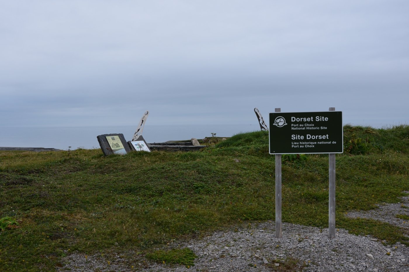
Looking back, I really wish I had chosen a book about Newfoundland’s ancient Indigenous people: the Maritime Archaic, early and late Palaeo-Eskimo, (Pre-Dorset, and Dorset), Groswater, up to and including today’s thriving Mi’kmaq culture. I could have appreciated what the attendant at the visitor center in Port Aux Choix, was trying to educate me about, Instead of glazing-over after thirty minutes of his tutelage. I hope I get to return with fresh eyes and ears one day and piece together some of that exciting archeological treasure. Regrettably, all I can present here is the Dorset Trail, as I hiked it. To the National Historic Site land mark, and the ecologically sensitive area I walked through. Here is a link if you wish further readings into ancient peoples of this area. https://www.heritage.nf.ca/articles/aboriginal/palaeo-eskimo.php
THE DORSET TRAIL
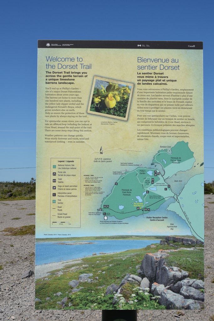
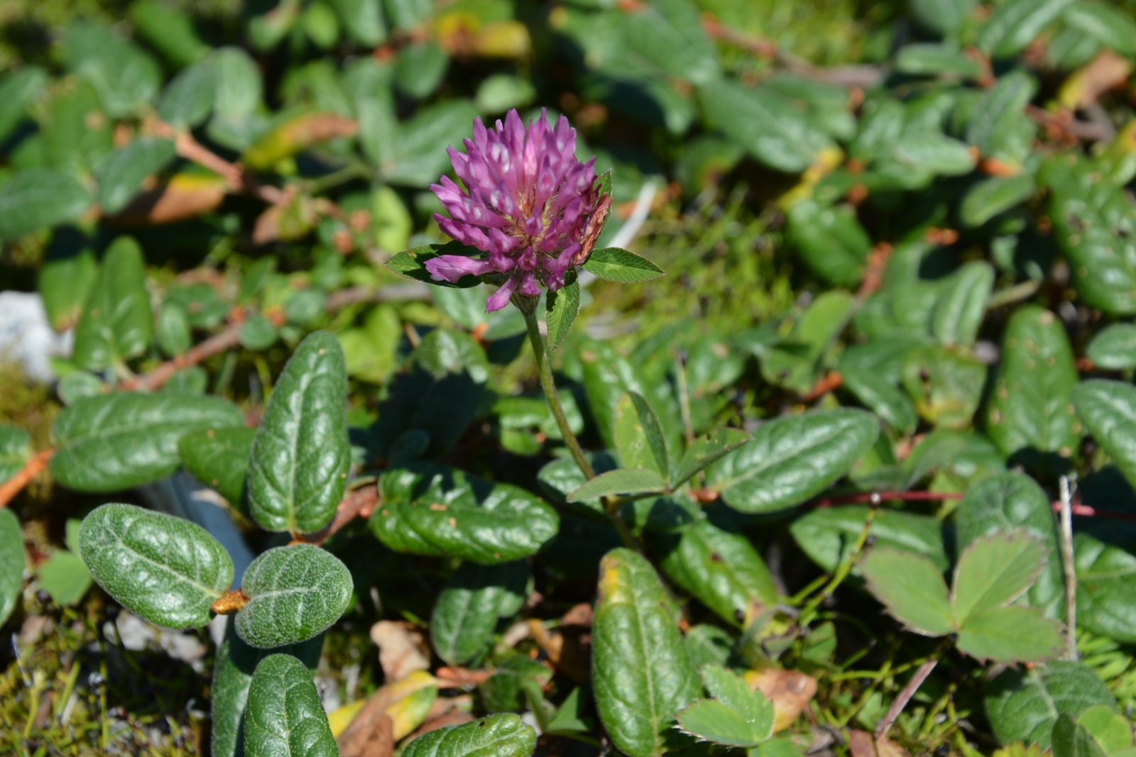
From the parking lots the trailhead of the Dorset trails looks like a gravel pit. Stones have been strategically placed to look like you are following a path that meanders towards something and I can’t figure out why I have to follow such an indirect course from A to B until I start seeing the tiniest of patches of ground cover and I realized I shouldn’t second guess the preservers of Canada’s National Historic sites. The path is designed to keep visitors from traipsing on some of the rarest flowers in Canada; the Fernald’s Braya, Long Braya and the yellow lady slipper.
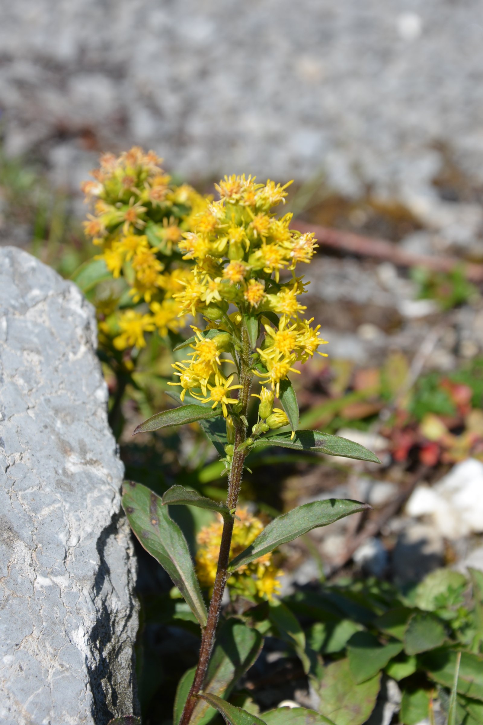
Now clued in, my eyes sweep the patches of the sparse greenery, hoping I will be able to recognize either one. I am not a botanist, just an ecology enthusiast, and my camera is ready should I find a Braya of any sort. I find some purple clover and a pretty yellow wildflower I was never able to identify.
A sign points me toward Philips Garden, only another 350 meters, so I keep going and welcome a break from the burning sun as the trail leads me under the canopy of a Tuckamore forest.
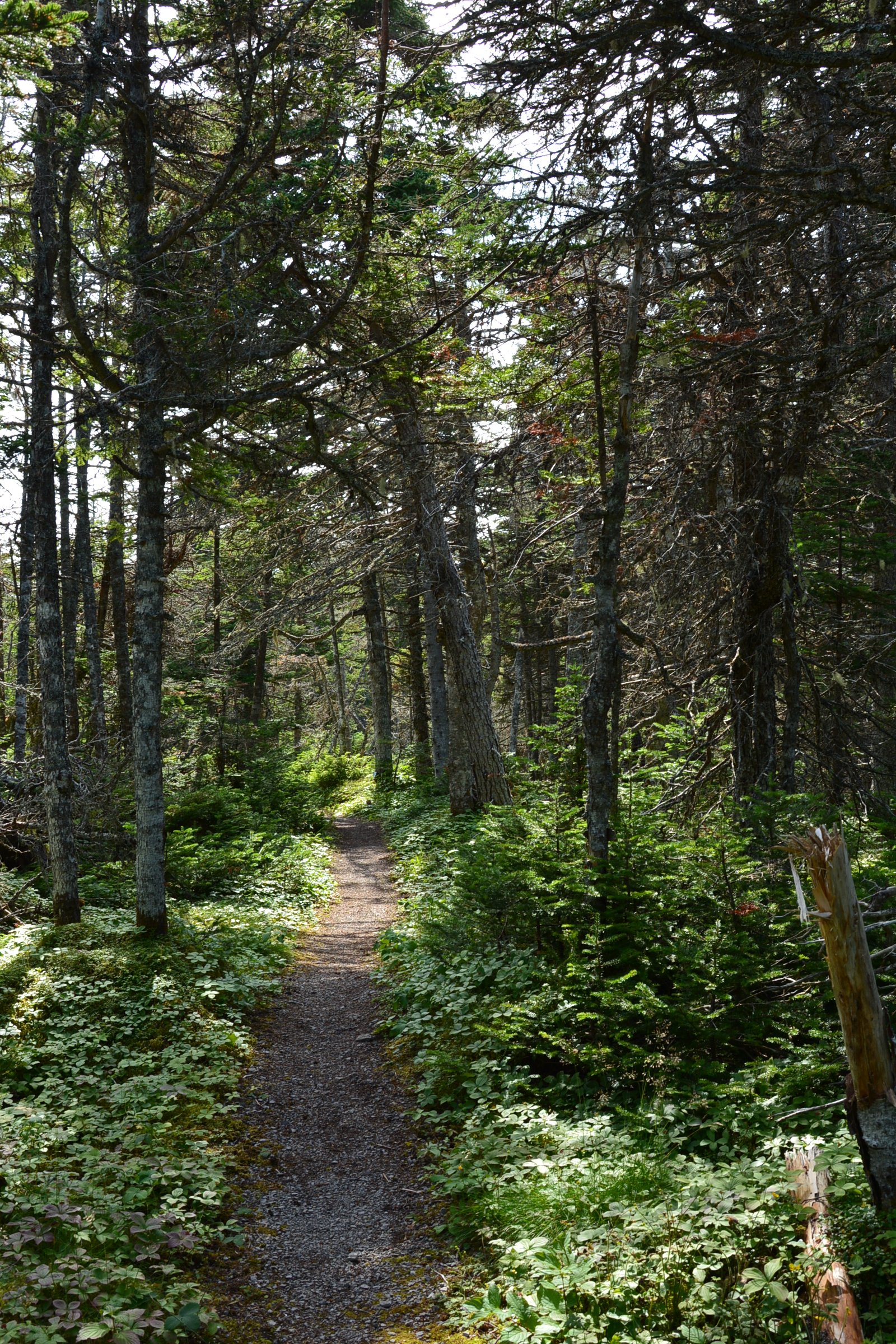
I see another sign pointing forward for a several hundred meters, then an arrow stating I should keep to the left for Phillips Garden. I follow the path over a dike at the edge of a pond, and then towards a a bridge, leaving the trees behind and back to the shore grasses.
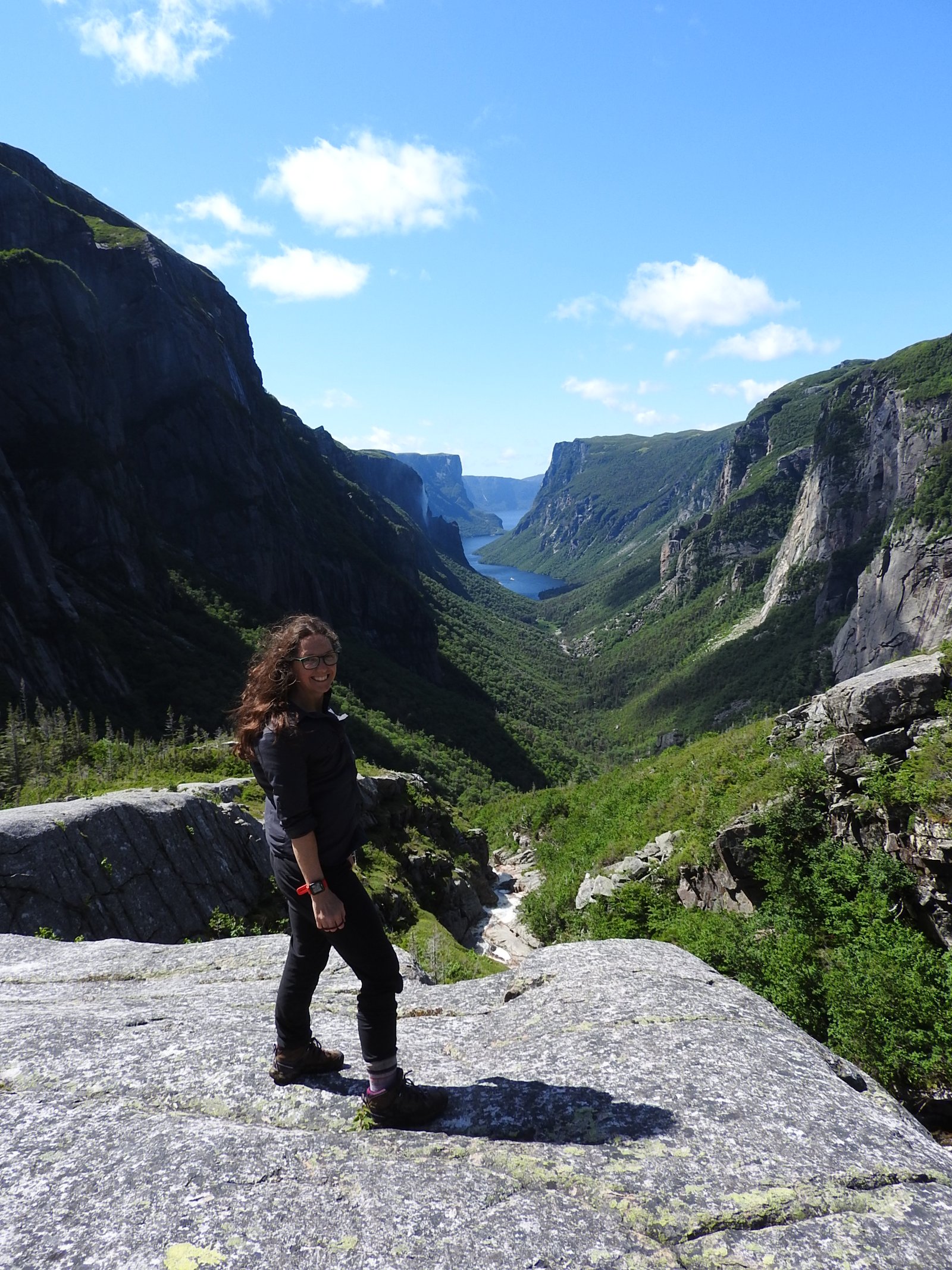
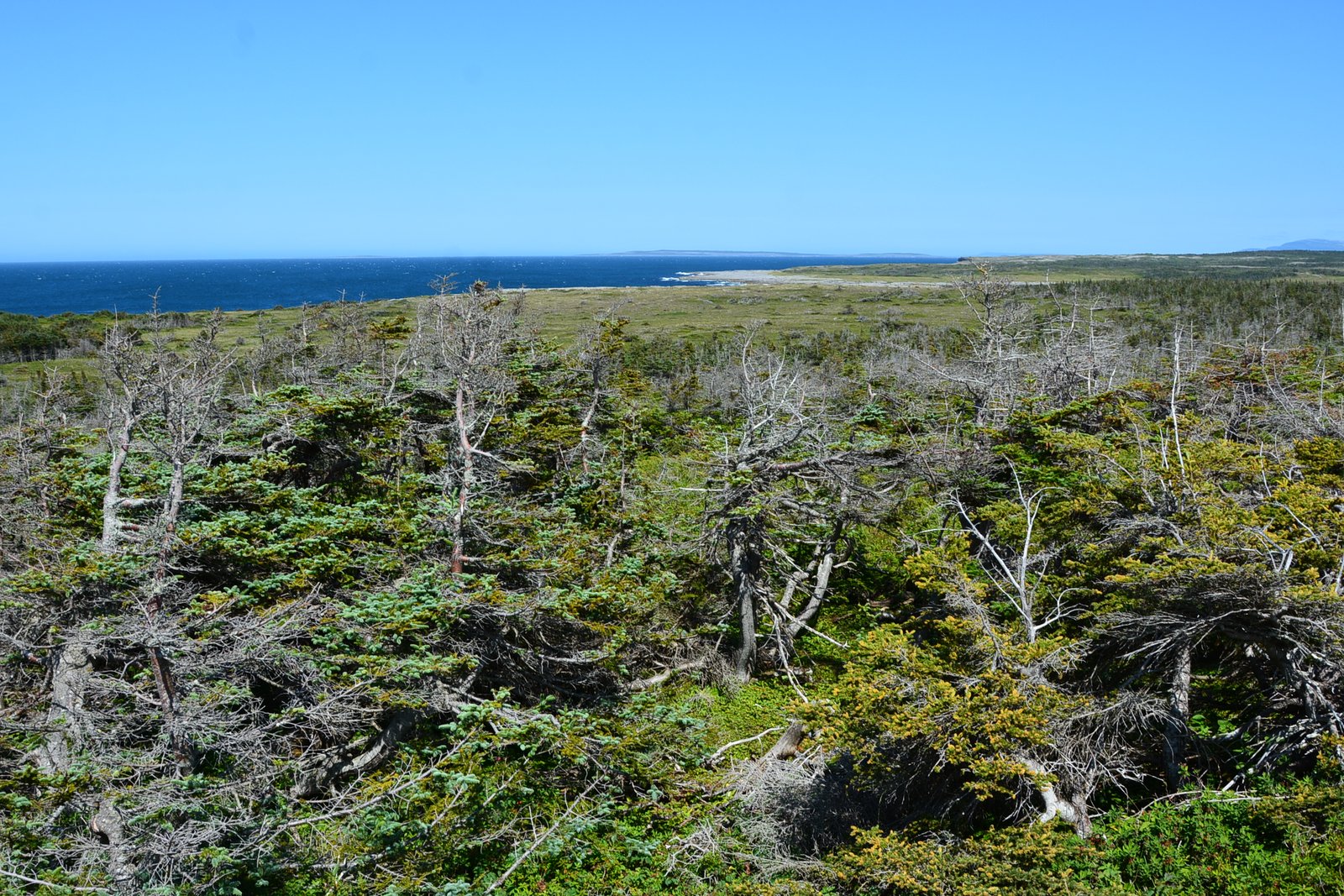
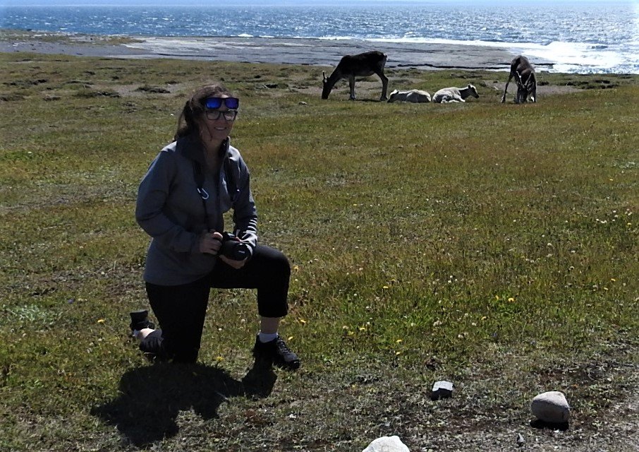
I have the trail all to myself this morning as I trot down a set of stairs to a narrow windswept path. The signage at the start of this hike said it was 3 km. I wrongly assumed that was out and back, it is obvious they meant one way because my watch is saying I have already done 3 km. At the crossroads of the path is a sign to Crows Head or Phillips Garden. I have to make a decision: keep going or return. I have drunk most of the water in my 500 ml bottle, which is slightly concerning, but I figuring I am adequately hydrated to make the return trip - I would hate to quit if my destination is just over the next hump. In for a penny in for a pound. It is unusually hot for this far north. I make a deal with myself, If I don’t see it within the next 500 meters, I will turn back. I come to an area, I can see over the Tuckamore trees and the Gulf of St Lawrence is right in front of me. It can’t be too far now.
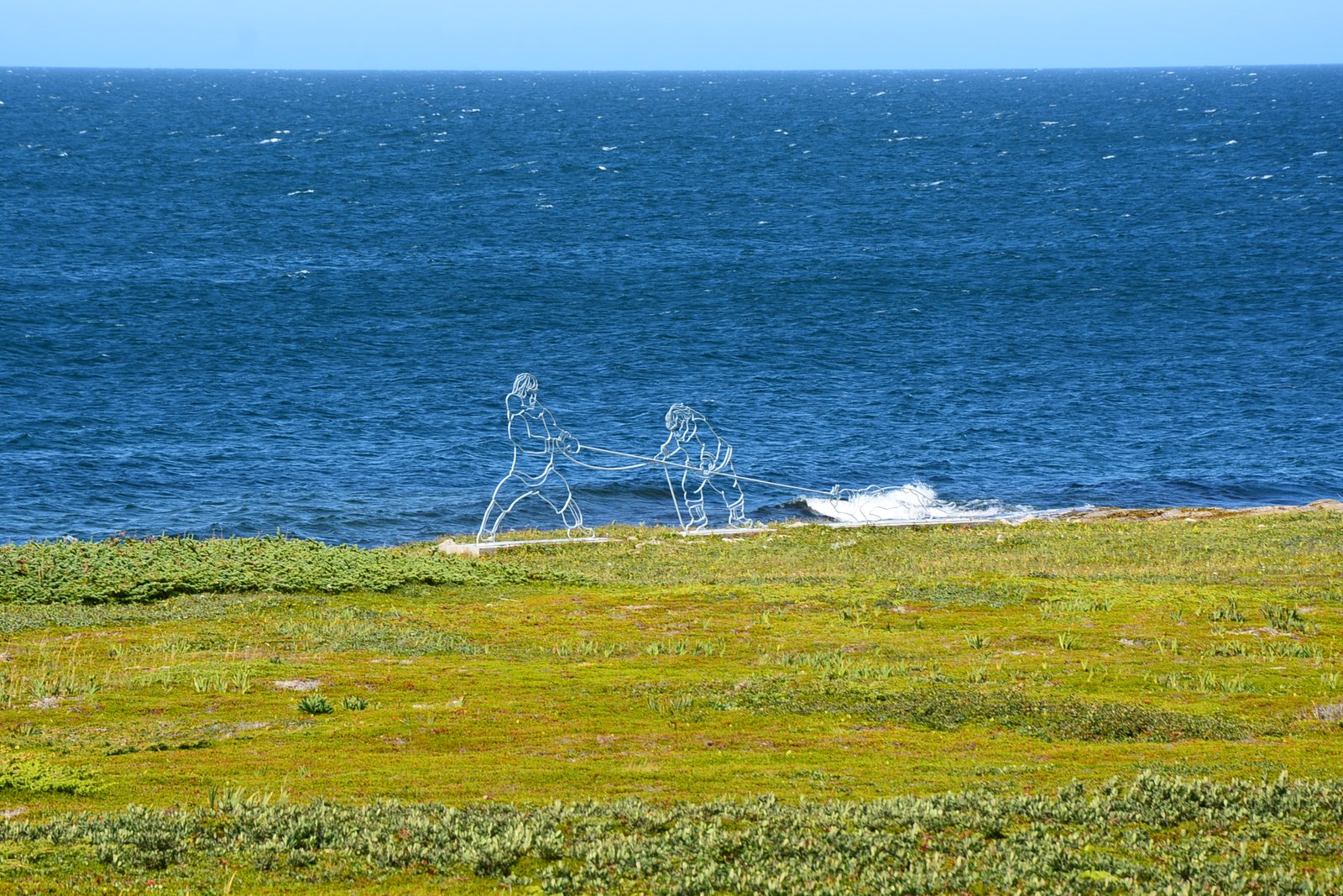
I had read about sculptures representing glimpses into the lifestyle of the Dorset people and I see one up ahead on the shore line. Two hunters with their takedown of a seal or perhaps a sled of some sort. I take a picture but I hope I have not come this far just to see an artist’s rendition of what life was like for these ancient people. I want something more tangible.
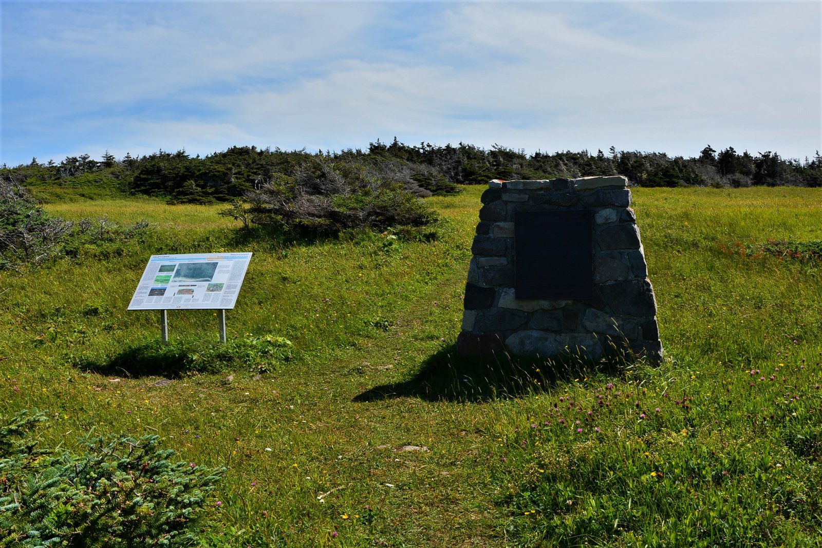
I have arrived in a hollow, and in front of me is a recognizable bronze plaque, mounted on a stone wall. It reads:
The Paleo-Eskimo Habitation
Between 4000 and 1000 years ago the eastern Canadian artic was occupied by a people known to archeologists as “Palaeo-Eskimos” The southernmost site of these peoples are found on the island of Newfoundland. At Phillips Garden two large settlement sites have been explored. One dating between 500 and 100 B.C and the other between A.D 100 and 600. In both case the well preserved remains of tools, weapons and discarded food bones have given archeologists a new appreciation of the materials and intellectual culture of the Palaeo-Eskimo people
-Historic site and monument board of Canada
I wander slowly up the grassy path that melts away into a flat field. I am hot and tired and I can’t identify what I am looking at or for. I would really liked to have the attendant from the visitor center with me now. He had spoken of stone cutting tools that were found and cataloged but I didn’t hone in on the archeological details of this site and I immediately regret not asking more questions. Lacking knowledge I am lost on how to enjoy this site further, and I gravitate to what is familiar- taking photos of the sea.
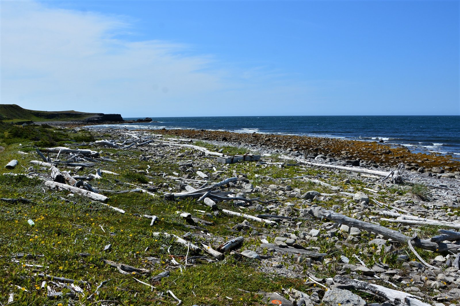
The coast looks so pretty, I wander up toward a pile of driftwood strewn about by waves. Further up the hill I see a sign for the coastal-trail that will take me back towards the light house and a long walk back to my truck at the visitor center. Nope, I am not doing that. I push myself up the bank and proceed back down the path the way I came.
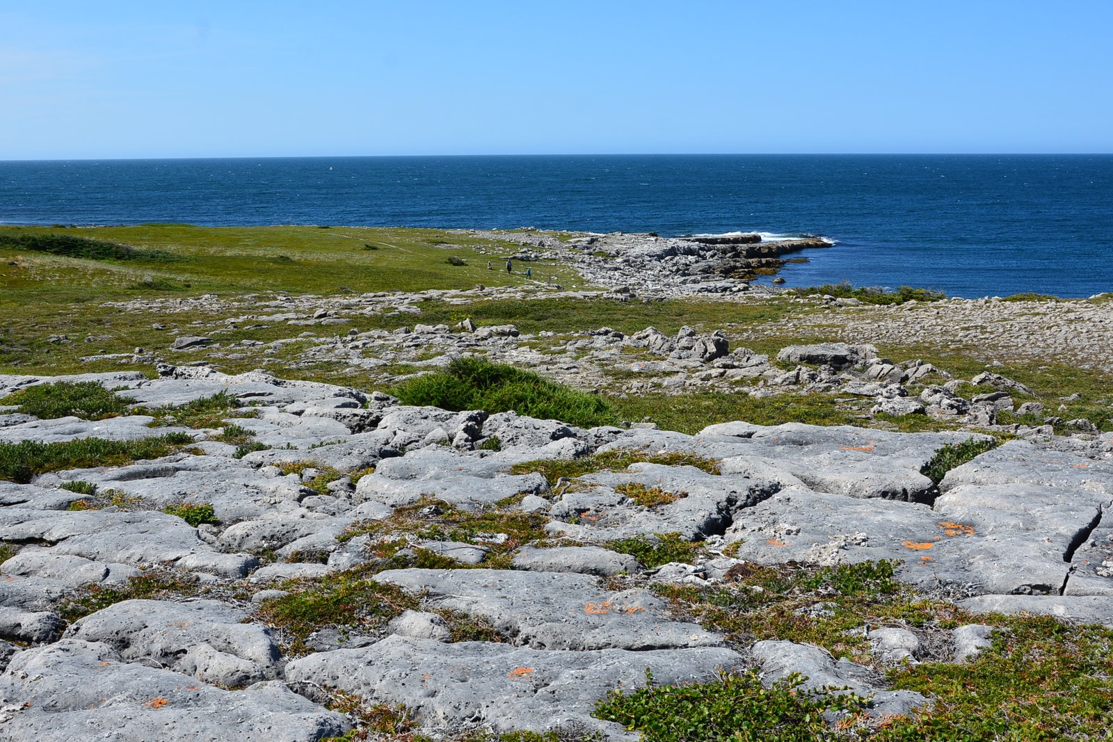
There is a spot where the limestone rocks are exposed like a jigsaw puzzle, I leap from one to the next. Again I wish for a guide, perhaps I would have found one of the rare Braya flowers.
Following my footsteps back along the trail, it seemed much further on the return. When I finally get to the truck I am parched. I flip up a 4 liter container of water on my forearm, with my finger hooked thru the handle guzzling it back like a moonshiner with a jug of white lightning. Smacking my lips I glance at my watch. The activity tracker recorded a 7.2 km hike. Good enough for today, but I have one more stop to make; a cemetery circle in the center of town, right off the main thoroughfare, that wouldn’t require much walking to get to. It is only about a 10 minutes drive away.
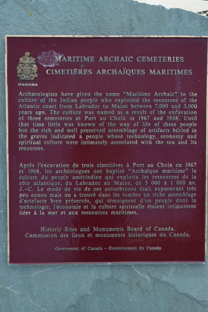
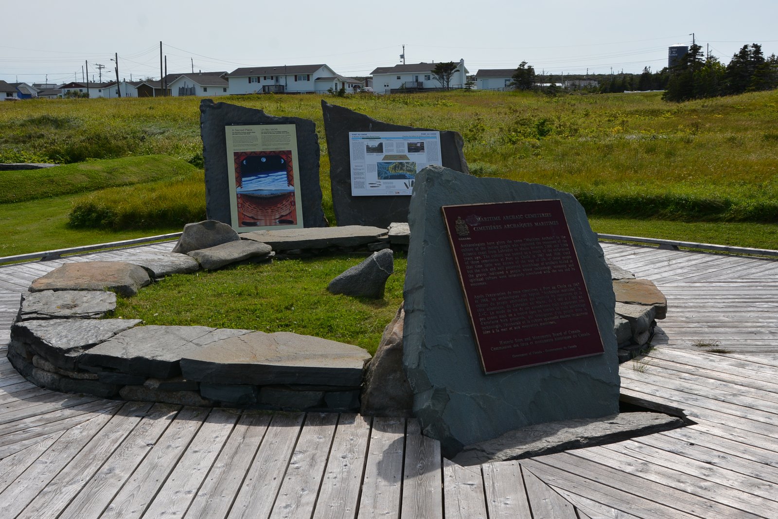
The above photo is a Maritime Archaic peoples cemetery.
“Archaeologists have given the name “Maritime Archaic” to the culture of the Indian People who exploited the resources of the Atlantic coast from Labrador to Maine between 7,000 and 3,000 years ago. The culture was named as a result of the excavation of three cemeteries at Port au Choix in 1967 and 1968. Until that time little was known of the way of life of these people but the rich and well preserved assemblage of artifacts buried in the graves indicated a people whose technology, economy and spiritual culture were intimately associated with the sea and its resources.”
-Historic Site and Monuments Board of Canada
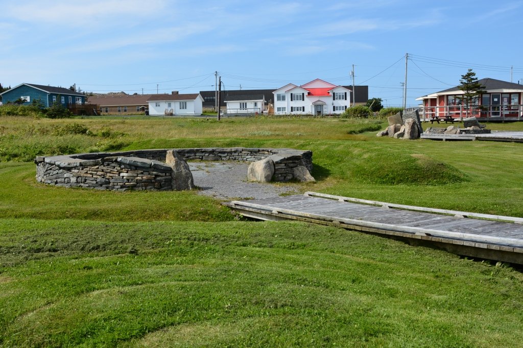
Two boardwalks radiate out from the center and I follow each of them, peering into the stone circles, hoping for a projection of enlightenment from the past. I received neither but this place has a very spiritual feel and I walk very quietly, scared of disturbing the sacred ground. I read the interpretive plaques and ponder the existence of this town that leaves me with lots of questions. How long it has been inhabited by people from ancient to modern times? And what has been undiscovered lying just below the ground I walked on all morning? I will have to read up on these people.
Looking up at the sun, I see it is pushing into late afternoon and I since I hope to spend tomorrow at L’Anse aux Meadows- the only confirmed Norse site in North America, I better get a wiggle on and head northward. Please join me as I follow the Viking trail to the top of the Great Northern Peninsula on the island of Newfoundland. First, I will be stopping in Flowers Cove, to see what the Marjorie Bridge & Thrombolites are all about .
Tip
if you enjoyed this content and found it helpful, you can tip me to show your apprecatiaon
CA$1.00


The yellow flower maybe a “Solidago” family plant or Goldenrod. I used Google lens on your photo and that was the result. 🤷🤷
LikeLiked by 2 people
Why thank you so much.
LikeLiked by 1 person
🙂 Google lens isn’t always right but it may get you into the ballpark. Lol. So I’m not sure how correct it is. I did a screenshot of your photo and then some cropping. So some details may have been lost. 🤷🤷
LikeLiked by 2 people
Understood, when I looked it up says it does grow in the area.
LikeLiked by 1 person
cool
LikeLike
Never having heard of Braya, I looked it up and found this article, which includes a photograph:
https://www.canada.ca/en/environment-climate-change/services/species-risk-public-registry/cosewic-assessments-status-reports/fernald-braya.html#_sum
LikeLiked by 2 people
Thank you wonderful place to look for plants and flowers.
LikeLike
Wow, so much rich history there, Kelly! Thanks for the tour. ❤️
LikeLiked by 2 people
I am glad you enjoyed it. John, Hope you had a good thanksgiving, Be well
LikeLiked by 2 people
Thanks, and you too, Kelly.
LikeLiked by 2 people
Very interesting, Kelly. And I understand the frustration of learning about yet another tragedy. There seem so many, now. Makes me want to hide my head in the sand. I know it is important to keep such history alive in our minds, but I yearn for balance. Looking forward to visit to the Viking settlements. –Curt
LikeLiked by 1 person
My sediment exactly. A person can only absorb so much horror. Everyone is looking for an escape route from disasters. My forewords weren’t needed in this piece but I needed to get it out there. Thanks always for stopping by and commenting Curt I very much appreciate it.
LikeLike
You are welcome, Kelly. And I am pretty sure our new trailer and truck will make it up your way one of these days. When I do, I’ll be back digging into your posts! –Curt
LikeLiked by 1 person
That would be great. Lots to see and do this way. And I’m already making notes from your post cheers
LikeLike
🙂
LikeLiked by 1 person
Intriguing landscapes and history out there - heavy going on many fronts, but I liked learning a little more about the land we share - thanks, Kelly!
LikeLiked by 1 person
NFLD is a fascinate place, it’s so under-appreciated, for its history, geology, meteorology, seismology, ecology, cultures, so much is there. I can’t wait to return. But I have lots more to write about on this trip. Thanks always and be safe 🙂
LikeLike
Glad you decided to carry on. Looks like a beautiful and fascinating place. I had to re-read the part about it being hot…I guess it happens once in a while.
LikeLiked by 1 person
Yes, it was so hot, there was a heat wave while I was there. It was 34 Celsius when I was in Mary’s Harbour Labrador. When I got to St Anthony’s You couldn’t buy ice anywhere , it was sold out at every gas station corner store and grocery store.
LikeLike
This is some awesome thinking. I love this! Wonderful ideas!💓
LikeLike
good luck , enjoy your logs
LikeLiked by 1 person
Thank you for commenting. Shyshahg.
LikeLike