48.6667° N, 65.8333° W
I have been wanting to go to the Gaspesie area as long as I can remember. I tried twice; once in early 90’s. It was late in the fall, maybe even early December. I remember it was cold, snow was collecting on the road and my inner voice told me it was a bad idea to proceed. I listened and turned at Riviere du Loup towards New Brunswick and onward to Nova Scotia to see family.
Then 10 years ago, I had another opportunity when I was moving back east from Ontario. For two days I held out, slowly driving northward from Riviere du Loup, on to Rimouski, inching my way to Mont Joli. My wipers couldn’t keep up with the torrential rain and with a white-knuckle grip on the steering wheel, I squinted through the windshield to see the road. I gave up and turned towards the Acadian coast of New Brunswick and kept going on to Cape Breton.
Since then I have had time to do research and I am glad that I didn’t make it on either of those two occasions. I would have missed out on so many places. When I was young I thought, I will come back again. Now that I am older, I realize how quickly years fly by and chances to revisit places don’t come around as we would like, if ever. I am lucky the Gaspe stayed on my list of must-see places. Other than missing the hike to Mont Saint Joseph, in Carleton Sur Mer, I had a mishap-free marvelous vacation. I highly recommend visiting.
Should you be interested in retracing my road tour, I did it from June 28th to July 5th 2019. I choose to drive the Eastern loop. Heading north from Campbellton, New-Brunswick be sure to stop at Miguasha-UNESCO-heritage-site. Next up is Carleton-Sur-Mer. then Saint-Alphonse for a hike to falls over a suspension bridge. Getting belayed down into the cave at Saint-Elzear was an adrenaline rush. A large cross marks the spot where Christopher Columbus held his first Mass in Port Daniels-Gascons.
From there I headed less than an hour north towards Perce. for the giant rock and to take a boat tour to Bonaventure-island to see the largest nesting site of northern gannets in the world.
I spent two nights and three days camping in Forillon-national-park, hiking to Lands End. I recounted my moose encounter in Forillon-national-park and some more hiking along the coast line and lighthouse area in Forillion-national-park.
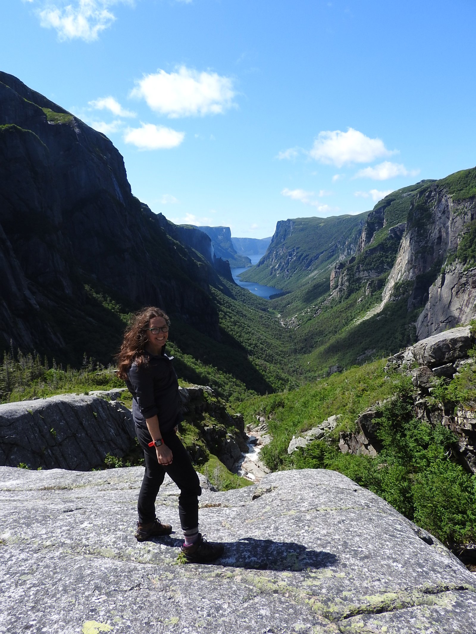
Nearing the most northerly section of the Gaspe, I found my first covered bridge and took in some local culture in Grand-vallee. The Saint Lawrence River is beautiful along the western coast, where I turned off and and headed into the chic-choc mountains of Parc-national-de-la-Gaspesie.
Within the park I attempted to hike to the top of Mont-Jacques-Cartier not only because it is the highest peak in Eastern Canada, but it is home to the last herd of caribou south of the Saint Lawrence River.
I did a little urban sight-seeing in the town of Matane before hopping on a bus and heading into the forest on a moose safari in Matane wildlife reserve.
There is a interesting story behind the naming of Philomenes-falls. I ended my tour at a historic fishing lodge not far from the area’s longest covered bridge, in Causapscal.
My 2020 vacation will be a month in Peru starting May 15th 2020. A lifetime of dreaming and two years of researching will finally become a reality. Until then please join me again as I explore new places. Happy travels from Maritime Mac.


I was so happy to read this, Kelly. When I was growing up, I had a friend whose family went EVERYWHERE, and he had just loved the Gaspesie. We have been talking for several years about how to navigate a trip there. Thanks for sharing your adventures!
LikeLike
You are welcome. I loved it and would go again. Hope you get there
LikeLike
We love the Gaspe. We traveled the route in the 80s and then never got back until 2018. We could not believe how beautiful it was. Thanks for sharing. Allan
LikeLiked by 1 person
My pleasure. It is an under rated destination. I really want to go back.
LikeLiked by 1 person
I look forward to hearing about your upcoming trip to Peru. You are so right about the years flying by. Oh, how I’d love to slow the clock down!
LikeLiked by 1 person
Can’t wait anymore, got to do it now.thanks for reading, hope I get time to do some posts when I get there
LikeLiked by 1 person
Certainly glad the weather behaved when I biked across it as part of my solo 10,000 mile bike trek in 1989, Kelly. I enjoyed the ride. Peggy and I drove across three years ago when I retraced my route. –Curt
LikeLike
You have done some wonderful travelling
LikeLike
A result of passion, luck, and pure escapism, Kelly. 🙂
LikeLiked by 1 person
It does take desire….
LikeLike
Seems like a great place to visit.
Is your Peru vacation still on with everything going around?
LikeLike
I have my fingers crossed. Covid 19 will fizzle out in 2 month. But it’s on my mind for sure.
LikeLiked by 1 person
I know. I sincerely hope the COVID19 dies down soon
LikeLiked by 1 person
Hello,
I was searching your blog but could find no contact info or e-mail address, so thought I would leave a comment on your latest post. I am a blogger myself and I grew up in Marysville New Brunswick. I’m writing a post about libraries, and in particular I want to mention the old library in Marysville. It was on Mill Street and I found your shot of a house on Mill Street in your 2017 blog about the Miramichi Trail. I think the house in the photo was the old post office/library back when I was a kid. May I use that photo (with credit and a link to your blog of course) in my post? I am clicking on the notification box in the hopes that you get back to me.
Many thanks,
Sue Burpee
http://www.highheelsinthewilderness.com
LikeLike
Sure, happy to help
LikeLiked by 1 person
Thanks, Kelly. 🙂
LikeLike